Cathedral Rock & Montague Thumbs Loop
Thursday, 8 June 2017
I've always been curious about the do-ability of the loop from the top of Cathedral Rock (which I've done a few times), along the Montague Thumbs Ridge, across to Wellington Falls, back to the Pipeline Track, down the Siphon track back to Northwest Bay River then back to the start - so when I happened to see someone's recent Strava post of that exact loop that they'd started at midnight (for specific training reasons) I figured that if they could do it in the dark, I could certainly do it in the daytime. So I picked the most sunny looking day of the week but as it was still very cold in the morning I left later than I usually would so the air could heat up a bit - I think it was still only about 7 degrees when I left at around 11am though, 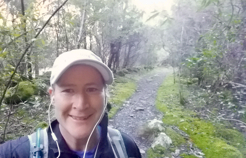
It took me just over an hour to make it to the top of Cathedral Rock, and I was surprised (and slightly concerned) to find frozen puddles and frost right up to the summit. Still, the views were amazing as always. 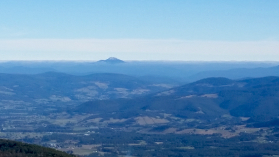
From there I had to traverse along the rocky ridgeline, following a faint (and often slippery) track. As I scrambled up and down I wondered how anyone could do it at night but perhaps it was easier because you couldn't see how close the drop off was! I got some nice views looking back towards Cathedral Rock (it's the pointy thing at the end of the ridge): 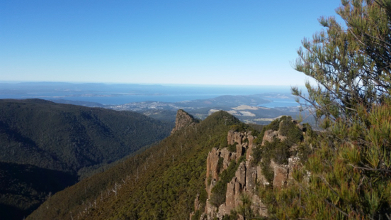
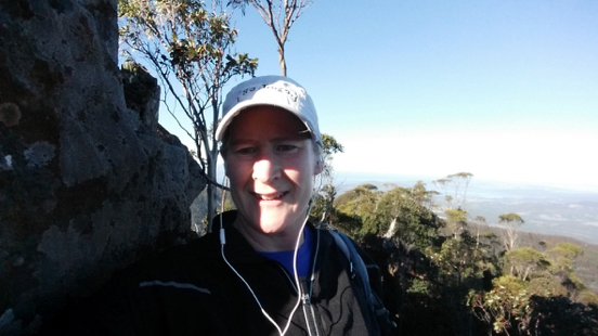
After that the track slowly descended towards Wellington Falls and it alternated between various forms of unpleasantness including being overgrown, rocky, vague & soaking wet. Parts of it must have been an old hunting or logging trail as there would be sudden sections of wide mossy track, followed just as suddenly by tight forest, or small boulderfields. It was generally hard going and the overgrown sections that I had to push though got me completely soaking wet which wasn't fun as despite the sunshine, it was still cold. This was a good section of it: 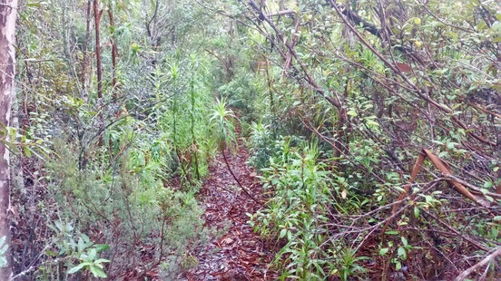
After what seemed like hours I finally made it to the river just above Wellington Falls - I breathed a bit of a sigh of relief at that point as the track markings had been so vague for so long that I had become a bit concerned that I might have accidentally ended up on another track. From memory I knew that after crossing I would join the well maintained Wellington Falls track to take me back to the Pipeline so the going was going to get a lot easier. 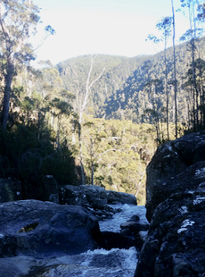 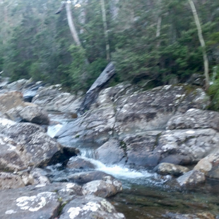
Only that was where I made a mistake. Actually I made two, no make that three, or possibly four mistakes. - the first was not having my Mt Wellington paper map with me (duh) as I'd decided just to use Strava's map on my phone to give me my locaton (and it didn't fit into my small bag). Strava didn't show that there was a crucial turn I needed to make once I was on the Wellington Falls track, in fact it didn't show any other tracks at all, so I ended up on a different track, climbing a lot higher than I needed to. I did wonder what was going on as I remembered the Wellington Falls track as being smooth and pleasant, and the track I was following was rough with steep bits. Neverheless I reassured myself that there was only one track in the area and it must be the one I was on so I must be remembering it wrong. So it was a good half an hour of arduous trail before I emerged at what was undoubtably the Potato Fields (a rocky boulder field way above the Pipeline Track and not near where I wanted to be). It was also at this point that my phone started to get very close to flat (mistake number 3 was starting with my phone on 60% of charge and listening to podcasts without thinking about battery!). I wasn't sure whether I should continue in the same direction and hit the Snake Plains track which I knew would drop me onto the Pipeline, or to heartbreakingly turn around and retrace my steps back to Wellington Falls. I tried to bring up a more detailed map on my phone but I couldn't and I wanted to save a few % of charge in case of emergency (btw I also had an EPIRB with me in case of real emergency). So after a brief stop for snacks and to consider my options* I decided to turn around. Backtracking wasn't as bad as I had thought it would be as it felt like it was more down than up and 25 minutes later I was back at the vague track juction. 50 metres past that I saw the big signpost which confirmed I was finally on the right track! And the track was as nice and smooth as I remembered, in fact the next 10 minutes of running were the nicest of the whole trip despite the fact I was pretty tired. Due to the battery issue I couldn't take any more photos on my phone which was a shame. I do have the Strava map though.. my out & back diversion is pretty obvious.. 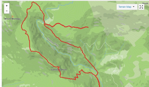
and take a look at the climb, the bumps after the halfway point is where I had to retrace my steps.. 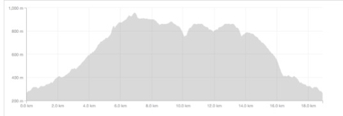
Once at the Pipeline Track I just had to cross it and descend what is known as the Siphon Track. It follows a large pipeline straight down the hill and is impossibly steep and slippery. Luckily it's also quite soft underfoot (good for landing on) and parts of it are quite incredible where it has been cut through the forest. It was quite an experience coming down it - I pity all those involved in making it! I tried to find some history of it on-line but all I could find were other blog tales of equally arduous adventures doing this circuit - some people mentioned it took them an hour to get down this section of track - I was lucky that it only took 15 minutes or so, others mentioned that the entire loop took them 10 hours. Gosh! The people who did it at midnight the other night took just under 4 hours all up and I took around 4:30 including my detour. I notice that Strava has assumed that I was stopped for a lot of that time and has told me that my total moving time was 2:54 which is complete rubbish as I stopped for maybe 20 minutes altogether it was just that some other sections were so slow it thought I was stopped. Anyway - I slipped and slid my way back down the Siphon Track back to North West Bay river and crossed easily (the river is quite low at the moment) then had just a few ks along the river's edge to make it back to the car. My total journey was 18.9k. The route without my Potato Fields detour is about 15k. I had been out for a lot longer than I expected so I was pretty happy to make it back to the car and drive straight to the supermarket for some late lunch! * I decided to turn around for two reasons - firstly I didn't know exactly how much further along I had to go before there was a trail that cut down to the pipeline track, then I would still have had to backtrack along the Pipeline to get back to where I needed to join my next track. As it turns out the trail back down to the Pipeline would have taken me an extra hour or more but I didn't know that at the time due to mistake 1. Secondly, Jon knew my intended route, and although I still had a bit of phone battery and my EPRIB, if anything happened and I couldn't contact anyone (say after a fall), no-one would have expected me to be up around the Potato Fields area.
|