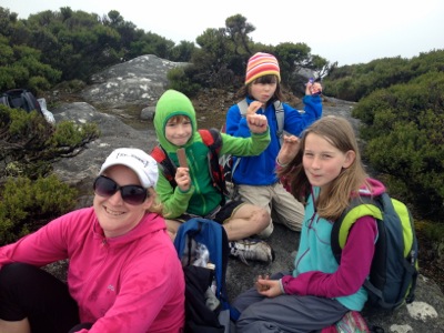
60 Walks Challenge - Walk #36
Saturday, 4 February 2017
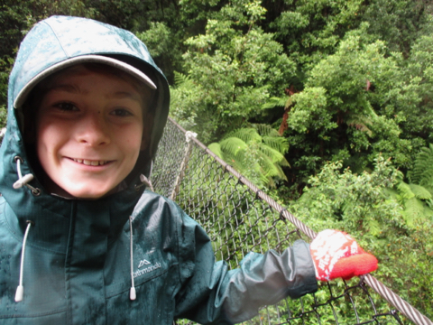
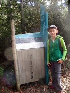
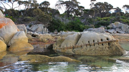
- Name : Montezuma Falls
- Distance : 8k (out and back
- Time : 2:15
- Official Walk Number : 27
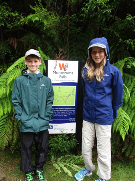 
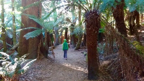
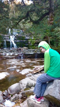
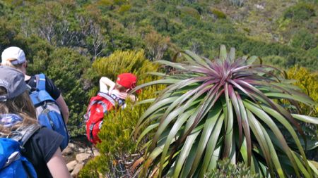
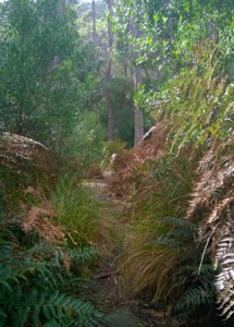
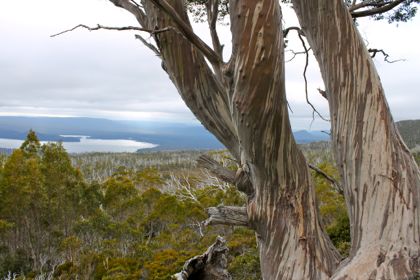
With Jon safely ensconced at the Cradle Mountain Lodge (undertaking caffeine loading no doubt), the kids and I headed to Lake St Clair via a walk that’s been an even longer time coming than Jon’s Cradle Mountain Run. Montezuma falls is close to Roseberry, which is so far nestled in the rugged west that you don’t go there unless your are on a mission - like the Wildside MTB race which we’ve been to twice, but the walking trail is closed when that’s on. With constant rain, and a track length of 4k each way, it could have been arduous, but in fact it was as smooth and almost-flat as the pipeline track on Mt Wellington - so it took us just over two hours all up to walk there, take photos, snack, walk back. There were muddy patches but nothing serious. The falls themselves were pretty cool too. 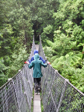 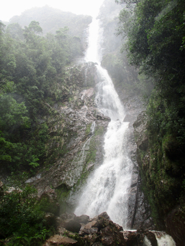
|
60 Walks Challenge - Walk #35
Thursday, 23 June 2016
- Name : Fern Glade
- Distance : 1k out and back
- Time : <1 hour
- Official Walk Numbers : 35
Fern Glade track starts out the back of an industrial suburb of Burnie. It's very popular with platypus and platypus spotters, and it's obviously a well loved picnic area. 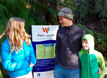 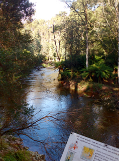
We arrived to do the walk just a week after some pretty serious floods and the damage was pretty evident - although it was also evident that a lot of clearing up had already been done. I found out afterwards that 'Friends of Fern Glade' has a very active Facebook page which I'm sure translates into a lot of hands willing to help clean up. 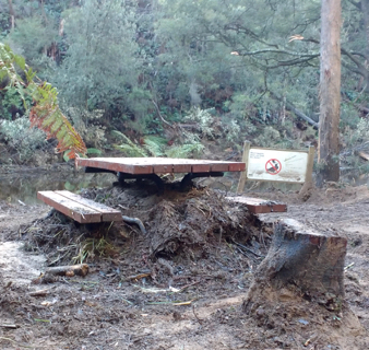 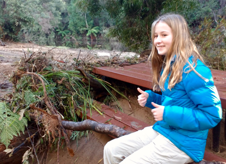
We did our walk between 2 orienteering sprint races in and around Burnie, so we didn't have heaps of time, but we didn't need it - it's just a stroll up and down the bank of the river really. It would have been really pretty and tranquil normally, instead it was really amazing (and sad) to see the destruction of the previous week. 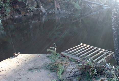
But, I"m sure in time it will be restored both by human and nature's touch to it's former peacefulness and tranquility. 
|
60 Walks Challenge - Walk #34
Wednesday, 20 April 2016
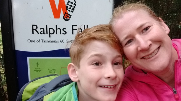
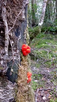
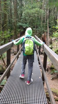
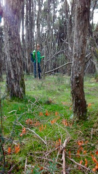
We said goodbye to Narawntapu National Park and travelled east towards Scottsdale. We only had a couple of walks left to do, so today was the day we'd be able to fit in some riding as well as a walk. It was good that Ms GoogleMaps was back at work as she helped me get smoothly through Launceston with just a quick stop for some more petrol and ice. The very welcoming lady at the Scottsdale information centre gave us information about where to park for the Rail Trail as well as grave predictions for our well being should we decide to visit Ralphs Falls. 'If you drive slowly, you *might* be ok' she told me. Actually I knew about the Ralphs Falls road - we had taken it 18 months ago, and survived (just) only to find the walking trail itself was closed. Back then the road was in terrible shape - it also climbed precariously up the side of a steep valley so it was just like one of those 'scariest roads ever' tv shows. I was mentally prepared for the ordeal but I was delighted to find that the council had done a lot of work to it since last time - it was still narrow and precarious, but at least free of deep ditches, huge potholes and dodgy looking edges dropping off the side of the hill. Yay! To top it off the walking trail was open this time too - clearly with a lot of work done to it as well - and it was a really lovely circuit with really varied vegetation and great views - well worth the dirt road and pre-drive nerves.. - Name : Ralphs Falls
- Distance : 4k circuit
- Time : 1 hour
- Official Walk Numbers : 50
Another picnic lunch and we were away again - heading for Derby and its beautiful new mountain bike trails.
|
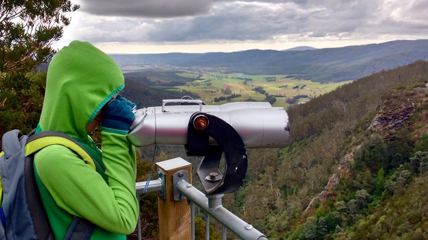
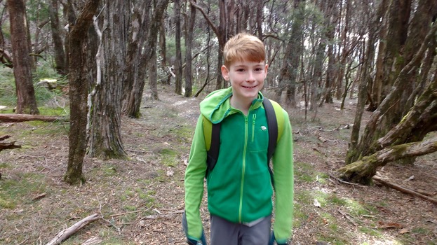
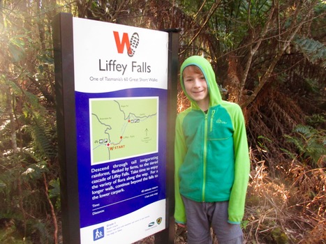
60 Walks Challenge - Walk #31 & #32 & #33
Wednesday, 20 April 2016
After a good nights sleep for Jett, and a fair bit of tossing and turning for me (it takes a while to get used to a thermarest - my hips are really sore by the morning) we were up at around 7.30 and packing up. We hit the dirt roads just before 9am and navigated our way back to the upper carpark for the official Liffey Falls Walk (a longer walk up to the falls could be done right from where we camped - we checked out the start of it the previous evening and it looked really nice but we felt we had to stick to the book to be able to tick it off officially). The top carpark had bike racks and bbqs and it was a really pretty 15 minute downhill walk through ferns and past smaller cascades to the bottom of the falls. It's probably not the best year to be looking at waterfalls and rivers - it's been so dry, but it was still really nice. - Name : Liffey Falls
- Distance : 2k return
- Time : 45 minutes
- Official Walk Numbers : 32

It was here that we brought out the very last Kvikk Lunsj that Bjorn had brought out for us from Norway. We'd been saving it for an adventure just like this! 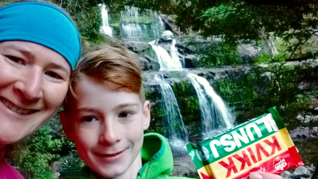
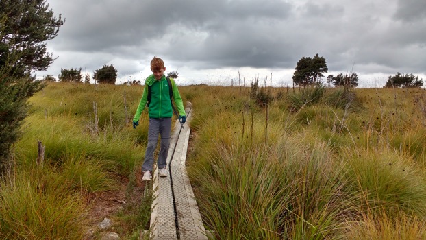
Then it was back to the paper maps to find the best route to Leven Canyon - which is about 45 minutes south of Ulverstone. With Ms GoogleMaps probably in rehab by now, we decided to take the easiest route on the big roads via Devonport. We stopped in for petrol and better maps at the information centre which was a relief - my new big paper map was not all that useful once we left the sealed roads. As it happened Leven Canyon was well signposted from the highway so we had no trouble - arriving at about 12. The picnic / camping site was really nice again - bbqs, toilets, grassy banks and ferns made it a place you'd linger (especially after suffering all the driving). We decided to set off on the walk, then have lunch afterwards.. - Name : Leven Canyon
- Distance : 1.2k circuit
- Time : 43 minutes
- Official Walk Numbers : 36
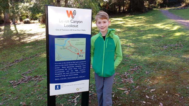 Leven Canyon is a short circuit - but Parks and Wildlife have really made the most of it - it has two pretty amazing viewing platforms and a long 600 step descent between the two. We spent some time at each, gazing over the hills and looking down into the canyon. It was a surprisingly warm & sunny day, so lovely to be out and about. Back at the picnic ground we had lunch, then set off for another long haul - back through Devonport then on to Narawntapu National Park, to tick off our last walk for the day - SpringLawn Nature Walk. I'd never been to this coastal park to the east of Devonport before - there was a nice information centre and a helpful ranger and I was expecting nice little walk with some nice vistas to the sea. 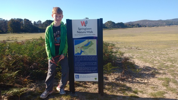
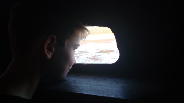
looking out the bird hide 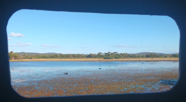

Well - it was strange - the 3.8k walk went to a lagoon thing and bird hide, then skirted faily boringly through scrappy scrub around the back of the dunes (no views), then inland around the other side of the lagoon (which was really just felt like a long walk through a paddock - as that's what it actually used to be, before the Park was made). 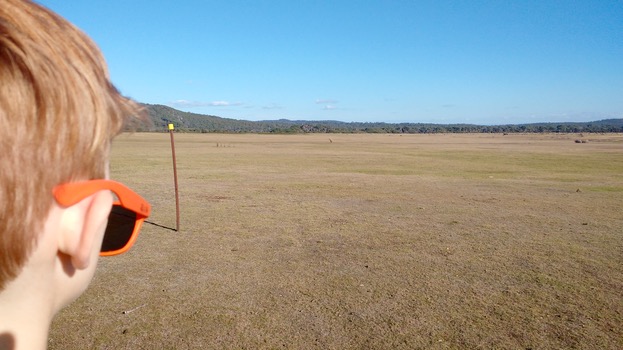
the paddock.. It was a strange choice for a Great Walk - there were other walks in the park that were a only slightly longer which would have taken us up a hill for views, AND gone via the seabird lagoon (if seabirds are your thing). I dunno what the reasoning was for this particular walk. 1/3 of the way through the paddock our enthusiasm had well and truly run out, and obvously the enthusiasm of the trail maker too, as the trail itself (as well as the directional markers) petered out and we were pretty much left to our own devices to complete the circuit and get back to the information centre (still around 1k away). I had picked up the little map of the area so we knew which way to go but any lesser adventurers might have got themselves lost by this point. Back at the visitor centre we celebrated our survival by splurging on an icecream (our spending had been entirely on petrol to that point) and the $13 camping fee then drove 4k out to Bakers Beach, one of the three camping areas within the park. Despite being the school holidays it was very quiet so we had no trouble finding an empty spot and setting up. Then we rode our bikes a few k back to a beach access point to get to see those veiws of the coast we'd been wanting to see earlier. That was fun. .jpg)
Back at the camp it was pasta for dinner, then a walk along the inlet (the bit facing Port Sorell), then we made hot chocolates and were in bed just after 8. 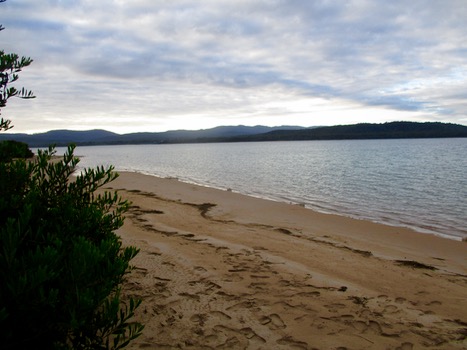
Camping in autumn is tricky - it gets dark at 6 - so you don't necessarily want to be cooking in the dark, but then you don't want to be going to bed at 7pm either! We generally tried to stretch out our evenings with a torchlight walk and some idle time staring into the fire and roasting marshmallows. |
60 Walks Challenge - Walk #29 & #30
Tuesday, 19 April 2016
It's currently school holidays, and with the prospect of not getting much time off between now and November when my project finishes, my boss encouraged me to take a few days now, while I still could. I had originally intended to take Clare with me and go and help at the Junior Orienteering Camp in St Helens that Zali was going to. But it turned out Jett was too young to participate as well so I decided to leave her to it, and do something just with him instead. During the week we had made a plan together to tackle some of the 60 Short Walks that we hadn't got to yet. So on Saturday morning we packed the car for 3 nights of car camping and headed off up the Great Lakes Road. Our first walk, conveniently right off the Highway, was the Pine Lake Walk: - Name : Pine Lake
- Distance : 800m return
- Time : 15 minutes
- Official Walk Numbers : 43
This walk was fully board walked and a great break from the driving: 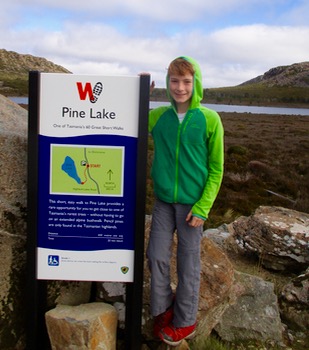 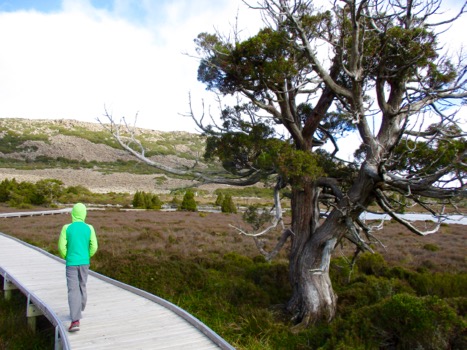
We had planned to do 3 walks on our first day, which looked close on the 60 Walks site, but in reality were a reasonable amount of driving & tricky navigation away from each other. To make matters more difficult, the google maps lady seemed to have taken the weekend off to go binge drinking, so she wasn't responding to my requests for help - leaving Jett and I to manage with a paper map we bought from Miena in the central highlands. 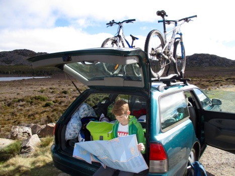
As the day was getting on, we decided to skip the closer but shorter walk, and tackle the longest one of our trip - Meander Falls. It was still over an hours driving away (still with no help from Mrs Google, who by now was no doubt catatonic outside some bar), and we finally arrived at the car park at about 12:30pm. I was a bit concerned that the web site had said this would take 4.5 hours of walking - so with the short autumn days (it's dark at 6pm), I was worried we wouldn't get back to our campsite (near the walk we were skipping), before it was dark. However as we drove into the car park we were presented with signs telling us it would take up to 6.5 hours to do this 10k walk - uh oh ! I added a head torch to our backpack and we headed off as quickly as possible. - Name : Meander Falls
- Distance : 10km
- Time : 3.5 hrs
- Official Walk Numbers : 44
 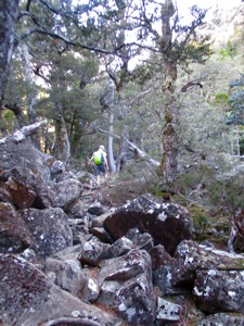 This walk was pretty rugged underfoot - and very steep - in fact it was a bit like Mt Strezlecki which was relentless in its climbing. The rugged trail went some way to explain why some of the signs warned we'd be walking at a slower pace than 2 kms an hour. Not Jett and I though - we walked at a fast clip and made it to the waterfall after about 90 minutes. I must admit that my quads are still sore from the effort! 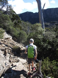 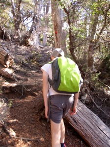
The waterfall was nice - I can imagine that on a hotter day you'd enjoy a swim there (and in some of the beautiful waterholes we passed on the way)- as it was Jett and I got cold very quickly sitting at the base of it. It was an unusual waterfall - it reminded me of the Hammersly Ranges in WA. 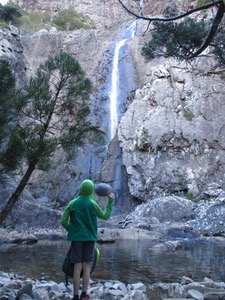 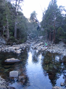 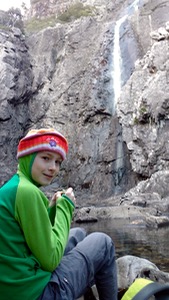
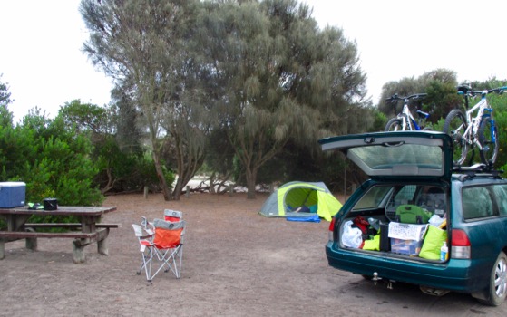
Without much time to spare we headed back down the trail, and headed back to the Lakes Highway and the Liffey Falls camping ground. Through some miracle of navigation and instinct we found our way to the (pretty much un-signposted) lower carpark and access point where you are allowed to camp. It was a fantastic camp ground - pretty and grassy and we were allowed to have a fire! There was even a fancy new flushing toilet - luxury. We quickly set ourselves up next to a quaint stream and settled in for the night - a great first day done! 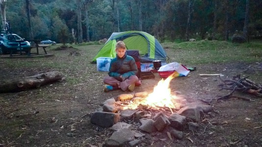
|
60 Walks Challenge - Walk #27 & #28
Sunday, 8 November 2015
- Name : Hartz Peak & Lake Esperence
- Distance : 7.5
- Time : 4hrs, lots of stops
- Official Walk Numbers : 11 & 12
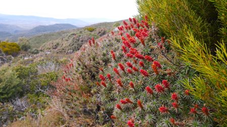
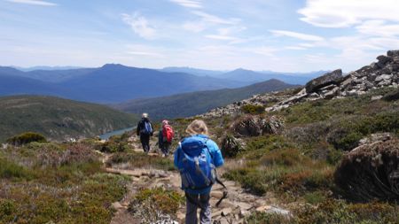
Hartz Mountains National Park is just over an hour's drive from our place. I haven't been there for ages though, and it's one of those places where you just don't visit unless the weather looks like it's going to be good - otherwise it can be really horrible with weather coming in from the south west. I expect that's why there is a brand new looking swanky lunch shelter at the car park - for all those visitors who arrive at the start of the walk, and think better of it due to the weather! Today it was forecast to be good, and the only issues were the wind on top of the ridge that we climbed up from about halfway to the top. We were pretty well prepared clothes wise, so it just meant lots of stops to put on and off layers as we moved in and out of the sheltered spots. As we descended from the peak the wind had picked up even further and we passed a whole lot of very lightly dressed people who would have been battling once they got up there. These people looked seriously underprepared, but on a day like today when the fine weather holds, they'd probably be fine. Anyway - the walk was great. Conveniently, Lake Esperence is right on the way to Hartz Peak, so it was a 2 for 1 day out. On a good day like today, Hartz Mountain National Park feels like an alpine garden, landscaped to perfection just for us. The waratahs will be out in a month or so, making it even more spectacular. 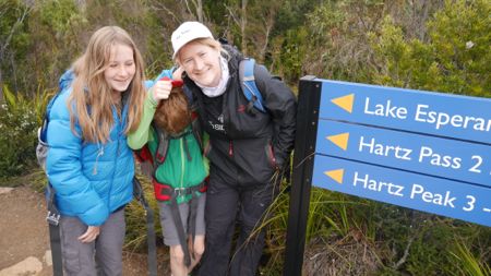
The trail is in immaculate condition - duck boarded or paved for most of the way, with only a few steep scrambly bits in the 2nd half of the ascent. 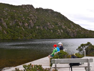
Lake Esperence - 1.7 k round trip, and well worth doing just for that. 
It was a like garden, there just for us to enjoy!! 
Behind Zali is Federation Peak and the rest of the very rugged looking south west. The views were sensational today. 
 Miley wasn't able to join us in the end, but the walk wasn't all that demanding, and packs weren't that heavy today. I think the kids both had a great time..  
and so did I.. 
|
60 Great Walks Challenge - Walk 26 & Before and After #33
Monday, 28 September 2015
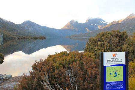
Lake St Clair - 6.35am Sunday 27th September 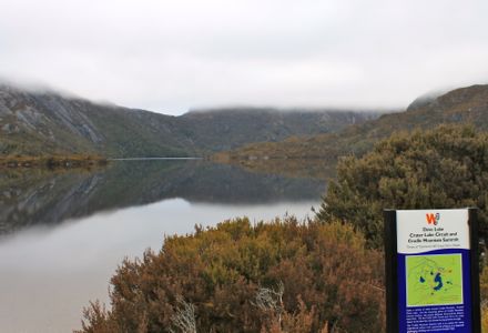
Lake St Clair - 7.45am Sunday 27th September - Name : Dove Lake Circuit
- Distance : 6.2k
- Time : 1hr 10 minutes, fast walking
- Official Walk Number : 29
I've done the Dove Lake Circuit a million times. It's a great walk but I really just needed to knock if off my official challenge list so I scooted around it first thing on Sunday (while Jon went for a 3hr training run). I have run it before but today I just walked (fast) as I'm suspicious I am still carrying an injury from my runs and walks at Port Arthur a few weeks ago. 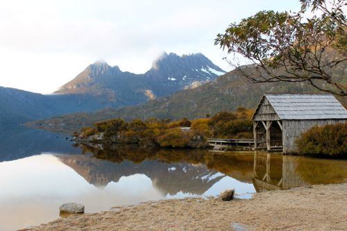
Being early meant I happened to have the best of the view. The reflections were amazing.. 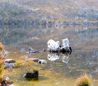
I also had the track to myself. Not least because it was officially closed due to track maintenance. I figured that since they only closed it the day before that I'd get away with sneaking around before any workers did anything serious to impede my way - it looks like they have a bit of work planned (replacing rusted metal raised walkways) - so I guess I was lucky to be able to get around it. Unfortunately having to walk (rather than run) meant I didn't quite have time to do the other 6k circuit that's on the Great Walks list - again, I've done it before but I just needed to tick it off officially. Next time.
|
60 Walks Challenge - Walk #25
Sunday, 13 September 2015
- Name : Cape Hauy
- Distance : 8.8k (4.4k each way)
- Time : 2hrs, 59mins, 04 seconds, including rests
- Official Walk Number : 5
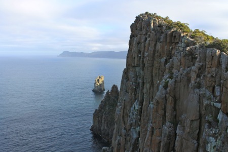
There being no rest for the wicked, Jon and I returned to our Glampsite for lunch with the kids, then we all headed back to Fortescue Bay once again to take on Great Walk number 3 for the day, Cape Huay. Unlike some of the other Great Walks I've done in this challenge, Cape Hauy really is a great walk. I first did it as a teenager, and I've probably done it 5 or 6 times since. The trail has been 'upgraded' since I first did it which I've discussed before and won't go into suffice to say that it now features a lot of steps. 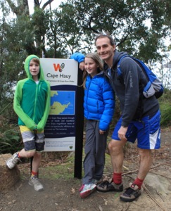 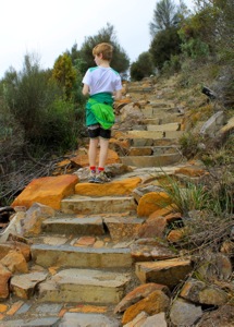
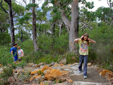
Luckily it also features lots of lovely bush and views as well. The spring flowers were particularly nice, as were the cockatoos which feast on the flowering banksias. 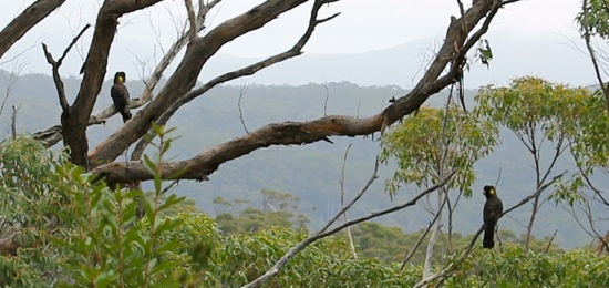
We were lucky with the weather and got to the end of the trail just as the sun hit the rocky tops of the Lanterns. 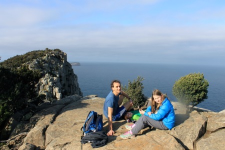
Jett was very keen to finish the walk in under 3 hours including breaks (the advertised time is 4 hours), so we found ourselves scampering down the last staircases and along the flats to finish in 2 hours 59 minutes. You can imagine how tired Jon and I were feeling after more than 20ks in our legs for the day. |
60 Walks Challenge - Walk #24
Sunday, 13 September 2015
- Name : Bivouac Bay
- Distance : 10k (5k each way)
- Time : 1hr 45
- Official Walk Number : 4
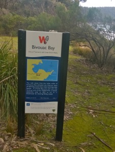 
Conveniently, the Great walk to Bivouac Bay starts from Fortescue Bay, and goes north towards Tasman Arch! Yay! - this meant that I would eventually meet Jon, on his way south..and so I did.. eventually. I must admit it took me a LOT longer to cover the 5k than I was expecting, but I can at least partially blame the track which was pretty rough underfoot. There were also a few steep pinches, of course not as steep or long as the hour long hill Jon had own his journey on his way south, but steep enough to reduce me to walking anyway. 
I was on my way back from Bivouac Bay when Jon caught up with me, so we ran the rest together which was nice. 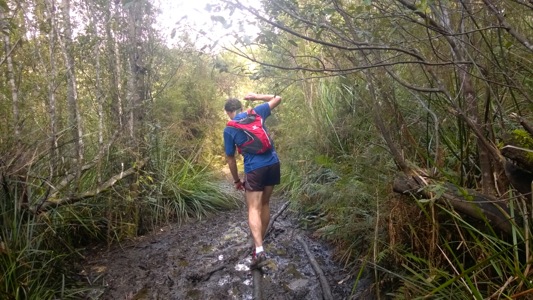
Arriving back at Fortescue Bay beach was great, because after Jon's long run, and my two shorter runs we were both exhausted.  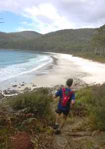
I must admit that I wasn't wowed by Bivouac Bay, the coastline was nice but the destination wasn't all that different from the other bays I passed along the way. In fact Canoe Bay, about half way to Bivouac Bay was a nicer destination as it had nice sunny spots to enjoy the views, and a shipwreck to look at. Still it was good to tick off my 2nd Great Walk for the day. |
60 Walks Challenge - Walk #23
Sunday, 13 September 2015
- Name : Waterfall Bay
- Distance : 3.4k (1.7 each way)
- Time : 30 mins (slow run)
- Official Walk Number : 3
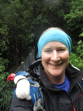
Waterfall Bay is at the north end of one of my favourite trail runs, the 18.5k Tasman Arch to Fortescue Bay run (or walk). I've done it a couple of times in each mode, and until late last week I was planning to run it again but logistics and a dodgy feeling back got the better of me. So instead I took Jon up to the start of it and ran the first 1.7k with him, which happened to be one of my Great 60 Short Walks. 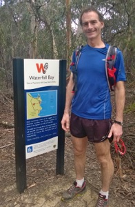 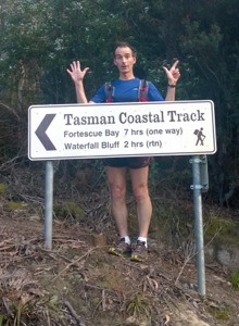
After I said goodbye to him (see above right picture), I shuffled back along the track to the car, taking a few photos on the way. 
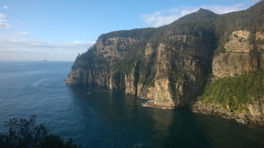
Then I drove back around to Fortescue Bay - which took just over half an hour. It was a nice start to the day and loosened up my back a little which was good. |
60 Walks Challenge - Walk #22
Sunday, 24 May 2015
- Name : Tamar Island
- Distance : 4k
- Time : 1hr
- Official Walk Number : 41
Tamar Island was a walk that definitely over-delivered. And being close to Launceston it has the advantage of being able to start the walk with your take-away coffees/hot chocolates in-hand - which was great as it was pretty nippy! 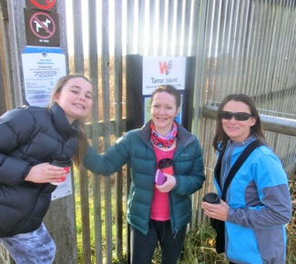 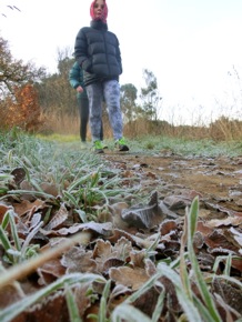
The walking crew today was Clare, her sister in law Jo, and niece Annabelle. This would be a great walk for bird lovers - as it stretches out to Tamar island from near Riverside in Launceston, mostly on boardwalks and through a variety of reeds and shrubs. 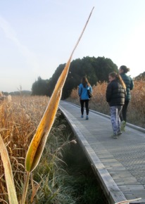 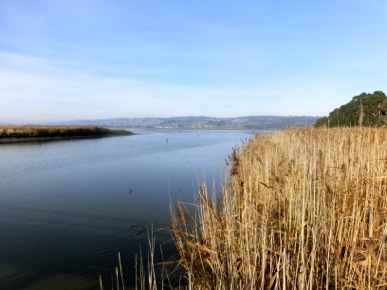  
Yep - so a nice easy flat walk to an island then return. It has a nice visitor centre that I'm sure every local primary school kid would have been dragged to on a school excursion at some stage! I think that knocks off all the suburban Launceston walks although I still have a few I did in January that I need to blog about before I can consider this area completely complete. |
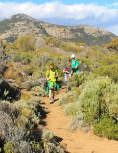
60 Walks Challenge - Walk #21
Monday, 6 April 2015
- Name: Trousers Point
- Distance: 1.9k
- Time: 1 hr
- Official Walk Number #46
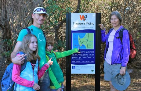
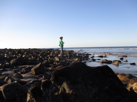
It turned out that Lyra had negotiated herself out of walking this walk (and by default, one of her carers), so here are the rest of us posing for the official sign photograph. Jett will be explaining himself when he wakes up.. This shortish circuit walk traces the headland of Trousers Point which is in the other section of Strzelecki National Park (it's split into two different sections - the mountain we climbed on Saturday is the other part). Trousers Point has a free campground which looks like it would be a great place to camp. In fact there are lots of great looking free camping spots dotted all around the island.
The photo on the right shows Alexa with one foot on (granite) rock from the Paleozoic era, and the other foot in the Cainozoic (limestone). This made her very happy. She is a geologist. 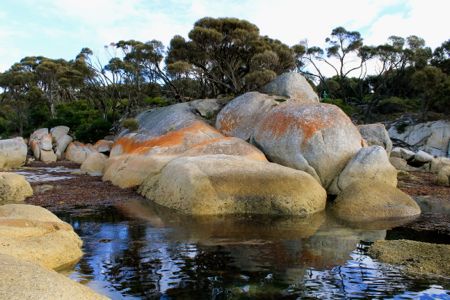
Rocks in Fotherington Bay. Which is just a fun place to say out loud. Fotherington. Fotherington. Ha!  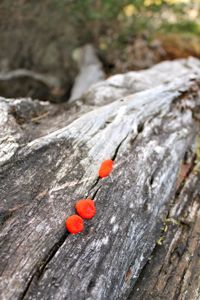
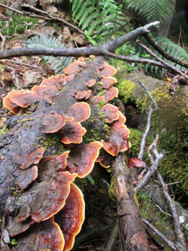
Views to the north and Some very red fungi on a log. 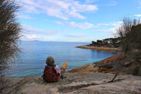
and Alexa admiring the views back at Trousers Point when we were finished. A cracker walk.
|
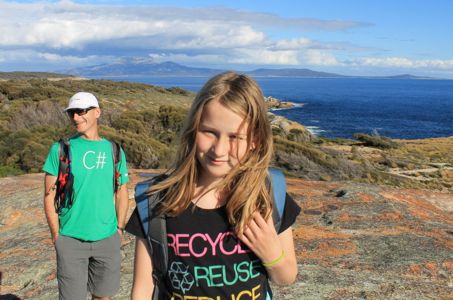
60 Walks Challenge - Walk #20
Saturday, 4 April 2015
- Name: Strzelecki Peaks
- Distance: 5.5k including 736m climb
- Time: 4.5 hrs
- Official Walk Number #47
This walk was steep. Almost unrelentingly steep from just a few minutes into it until we reached the top about 2 hours and 20 minutes later. We rested every 30 minutes on the way way up, so the total walking time uphill was just under 2 hrs. Mt Strzelecki forms part of the legendary 3 peaks race, a race where teams must sail to nearby ports then disgorge their undoubtably seasick runners to run to the top of one of three peaks and return, regardless of the time of day or weather conditions. Jon's dad competed in the 3 peaks race in the late 80s, when he was team mates with legendary ultra marathon runner Yiannis Kouros. Unfortunately I can't seem to find out how they went that year as there aren't many results on-line, however to even complete the single run on Flinders Island which constitutes about 58kms of gravel road, with the 3k ascent with 736 m vertical climb thrown in at the half way point, is very very impressive. 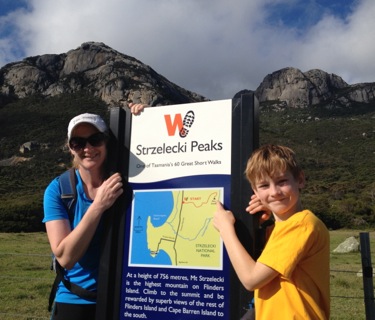 Today we were walking with Andy, Alexa and young Lyra who had arrived safely the night before. We are so close to the airport that we can actually hear their plane taxi along the run way. Luckily there are only two flights a day! 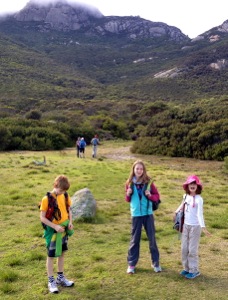 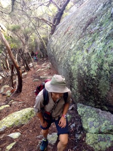
Anyway, as I mentioned this walk goes straight up, it's also rocky and rugged underfoot - similar in terrain to Mt Amos but with less smooth rock faces to negotiate, just rugged steps and roots. The trail is listed as taking 4-5 hours but I was a bit worried that we might take up to 7 hours given how much slower we were than the advertised time the day before, and the fact that two out of the previous three walking groups in the registration book had taken over 6 hours! 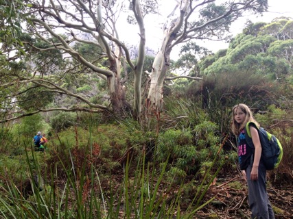
Zali on our way up. The trail went through all types of vegetation, from tea tree scrub, to gums, to stunted alpine shrubs, as well as passing by gorgeous steams and beautiful waterfalls. Right up at the top there was intermittent cloud cover which was occasionally eerie until it cleared and gave us great views down below. 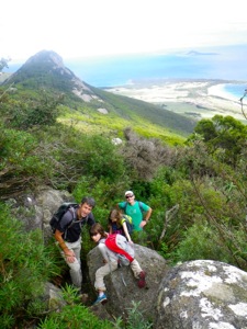 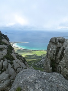 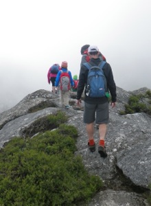
Celebrating on the top! 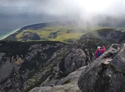
The cloud sweeping across the sky  
Coming down! Back at the bottom we drove to Trousers Point which was just a few minutes away and went for a quick swim in the almost deserted bay. 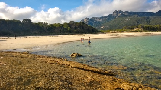
On our first break about 30 minutes into the walk we could see way down to our car and we noticed a car had parked behind us. We were going reasonably slowly because of the kids, so I thought to myself that it would not be long before we saw those walkers come past us. Surprisingly we didn't see them at all until we were on our way down, having spent a good half an hour savouring the top of the climb, and being already 20 minutes into the descent. The other group looked like it contained two parents and two teenage children. They must have slowed up even further as their car was still parked at the bottom after we had spent more than an hour swimming and playing on the beach. I guess that's the sort of pace which makes the walk take more than 6 hours and I hope they made it back ok! All of our kids really did well today - as it would have been their steepest walk ever. Lyra had her ups and downs which was fair enough as she's only 9 and it was a great effort to finish. Zali was stoic despite getting a blister on the sole of her foot early on, and Jett just bounced up and down it with no problems at all. 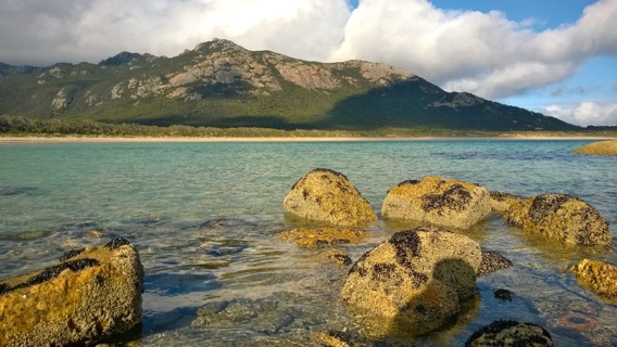
Another spectacular day on a spectacular island! Tomorrow I think we will be giving the walking a miss as we've allowed the kids to design the day. First up will be an Easter egg hunt, which will be followed by a day of Killiekrankie diamond hunting! I'm looking forward to it!
|
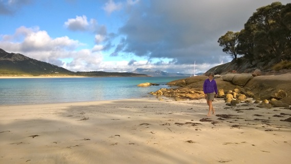
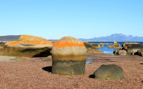
60 Walks Challenge - Walk #19
Friday, 3 April 2015
- Name: Castle Rock
- Distance: 6.6k
- Time: 2ish hrs
- Official Walk Number #45
It's been a while since I've completed and/or written up a Great Walk - so this was a pretty great one to get back on the wagon with. 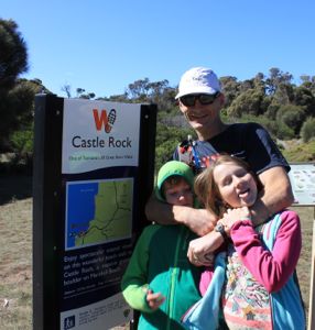
As always the kids were super keen to walk! Actually it was such a beautiful day and location they really didn't need too much persuasion. 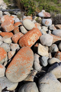 
The walk was a coastal out and back from the car park/paddock to a huge granite boulder called Castle Rock. So we were mostly on beaches with small bits of headland in between. The rocks were as orange as I've ever seen them to be. 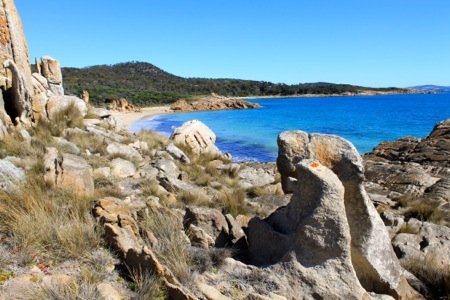
And whilst I grumbled along the way that the rocks we run past while we are orienteering at St Helens are probably at least as big, when we got there it did turn out to be quite big indeed! 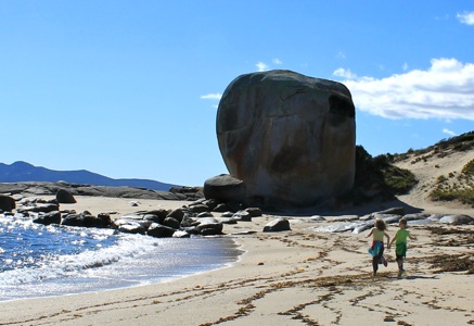
it's big! 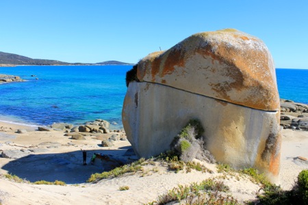
and now it's even bigger! That's Jon standing below it to the left After we checked it out Jon took his 2nd nude swim for the year.. 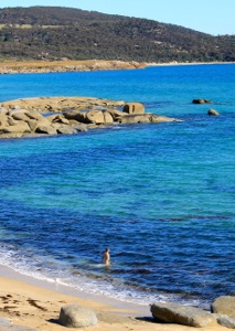 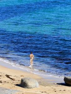
Quite different conditions to his first one in the snow and ice behind Drammen! After we played around the rock for a bit longer we headed back to the car. I should mention that although the signs and website say the walk takes 1.5 hours, we walked pretty fast and even ran bits, and we would have been pushing to do it in 50-55 minutes each way without time to enjoy it when we got there. As it was we took around 2-.2.5 hours all up. On our way home we stopped at Sawyers Beach which has once been rated as Australia's best beach. I disagree though - it's nice but I recon we passed 5 nicer ones already today. 
THe view across to the Strzlecki range is pretty nice though - I'm hoping we get to tackle that tomorrow with the full crew. Since I began writing I've had news that Andy and Alexa are on their way.
|
60 Walks Challenge - Walk #18
Friday, 24 October 2014
- Name: Mt Rufus (incorporating Shadow Lake Circuit)
- Distance: 18.5k
- Time: 5hrs 30 mins
- Official Walk Number #19 & #20
Julie and I both agree that we probably saved the best until last (and we're talking about a very fine group of walks that we've done this week so that is high praise!). The Mt Rufus circuit was really fantastic. The last time I did this was with Clare when we ran it in the 90s and whilst the track has been upgraded a lot since (lots more duckboards) the views are still amazing. As you can tell by the photos, today was a bit colder and we started a bit earlier than usual (8am), so we finally wore some of the clothes that we'd been carrying around in our packs all week. 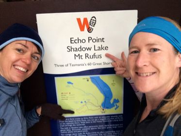 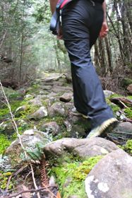
We did the walk in the recommended clockwise direction (which is different to how Clare and I ran it as it happens), and we climbed steadily for the first hour or so through the usual variation of woody scrub and mossy myrtle forests. Some of the moss was like the fake spiderwebs you might hang up at Halloween.. 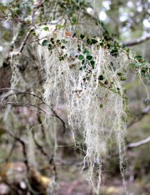 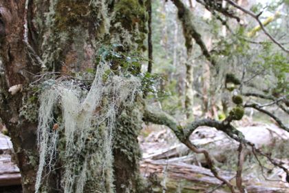
  After almost 2 hours, we emerged on top of a ridge above the treeline, and much to our surprise we were greeted with howling winds and fast moving clouds.  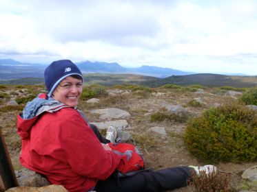
It was quite hard to get our warmer gear out of our bags and onto ourselves before it blew away - the best bet was to stay low down like Julie did. It wasn't raining, but the wind chill factor really brought the apparent temperature down. 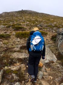  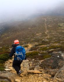
After about half an hour of battling the freezing winds we made it to the summit, which we briefly enjoyed huddled next to the large rock pile before we started down the next ridge. Unfortunately this was straight into the wind, although we did at least have gravity on our side! The views were still great when they emerged briefly from the clouds. As soon as we got off the ridge, it was as if we had imagined the whole 'enough-wind-to-blow-you-to-Frenchmans-Cap' thing - as it was calm and lovely again and the trail wound its way down a mossy pandani laden valley. 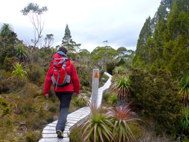 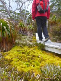
We had lunch at Shadow Lake, which, after 4 hours of pretty solid walking was very much enjoyed.  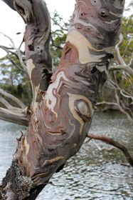
Then we just had the last gentle descent back to Lake St Clair. 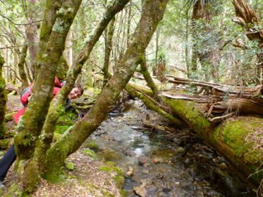 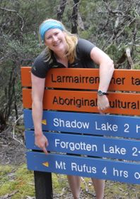
And then we were back and done. In 5 days we've completed 11 of the 60 great walks, and covered over 70kms. Aside from when I did the Overland Track, I've never done so much walking in a week. And it's been great - we got almost perfect weather and had great fun. My legs feel fine (today anyway!) and I'm just disappointed we can't continue our adventure for another week - after all there's still 40 or so left to do!
|